2007 Walk
PADDY WADDELL's RAILWAY
Sunday 9 September, 2007
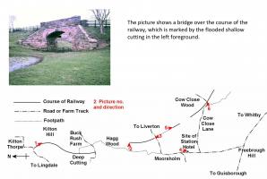
Paddy Waddell's Railway was never completed but many earthworks can still be seen. It was intended to convey ironstone from the moors to the blast furnaces but didn't attract the funds it needed. You can explore the whole 10.5 miles yourself by clicking this link. Our walk crosses the course of the line twice.
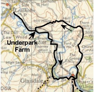 Our 2007 Sponsored Walk starts from Lealholm car park and goes alongside the river via
Underpark Farm and Rake Farm. At Rake Farm, we cross a nice stone bridge over Paddy Waddell's
Railway. Continue past the Mill House to Glaisdale. The Short Walk (6 miles) goes by road via
the Arncliff Arms, the Beggars Bridge and Egton Banks to the top of the hill. Instead of turning
right with the road, cross to Thornhill Farm then to Hall Park Farm and Hill House Farm.
Between Thornhill Farm and Hall Park Farm, the course of the Railway is crossed again. Skirt
Carr Wood and at Underpark Farm join the outward route for the return to Lealholm. (Note that
the pub Arncliff Arms omits the middle 'e'.)

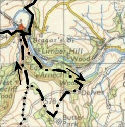 Two diversions provide extra mileage. The Arnecliff Walk (8 miles including the Short Walk) leaves the Short Walk at Beggars Bridge, goes through Arnecliff Woods and turns right on reaching the road. It bears left towards Butter Park Farm, but turns right before reaching it to cross the road to go through a small copse. A track is reached which leads back to Beggars Bridge.
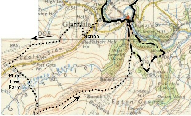
The Glaisdale Walk (11.5 miles including most of the Short Walk) leaves the Short Walk at Glaisdale village and passes the Primary School. A path behind the school is taken to reach the track along Glaisdale Rigg. Leave this to return to the road and cross the dale past Plum Tree Farm to Low Gill Beck Farm. Go up the hill to join a path along the 250 metre contour which is followed to a car park by a cattle grid. (The contours on the map are marked in feet). From here, go down the road for about half a mile to reach a track which is followed to Beggars Bridge to rejoin the Short Walk.
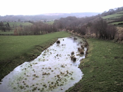 Looking south from Rake Farm - the final stretch of Paddy Waddell's Railway approaching the Whitby branch which can be seen crossing diagonally across the picture beyond the flooded cutting.
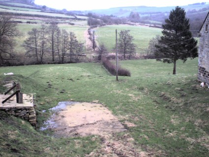 Looking north from the same spot - the river Esk crosses the picture horizontally, identified by a line of trees on the left. In front of these is the embankment.
These maps are reproduced from the npemap.org.uk site under the conditions of Creative Commons Attribution-NonCommercial Licence 2.5.
Related pages...
The Millennium Walk
Charles Wyatt Memorial Walk
more Charles Wyatt Memorial Walk
2006 Walk
2008 Walk
2009 Walk
2010 Walk
2011 Walk
2012 Walk
2013 Walk
more A description of our last but one Sponsored Walk
2014 Walk
more Goodbye to all our friends .....
