Bexhill Online Street Mapping
Wed, May 1st 2019 at 7:00 pm - 10:00 pm
by Alexis Markwick
Our guest speaker on Wednesday 1 May 2019 was Alexis Markwick, the creator, researcher and developer of an interactive online map of Bexhill which is available for free to everybody. Bought up in west London and then commuting into London to work as a software engineer and computer repairer Alexis decided to take a gap year – lasting 6 years - before returning to London. Losing the desire to work in London he took the decision to move away from the area and chose Bexhill, a town he had known when growing up. Having a love of maps he decided to create a digital map of Bexhill. Bexhill-OSM is a community based, open mapping project, which aims to help people discover a wealth of information on places in and around the town. Much of the “creating time” is spent out of doors mapping and recording local features and, to date, within the 15 square miles the map covers, he has recorded 35,000 points of interest, 20,000 buildings, 1100 photographs, 500 businesses, 250 miles of roads/paths, 16 research articles and 12 historical maps. By clicking on various symbols the user can find out about leisure, tourism and activities in the town as well as exploring amenities, services and shops. Clicking on the appropriate button will bring up information related to that particular activity, place or building such as opening times and accessibility. The map also includes history features relevant to the town such as World War11 bomb raids and Martello tower locations. A further feature is to be able to overlay the current with historic maps and see the changes over the period. Looking to the future he wishes to include aerial images and hopes that his map can be used for community projects – Rotary’s hearing link project is may be feasible – and helping school children to read and enjoy maps. There are opportunities for tourism use in the production of paper maps and touch screen information panels and Alexis is keen to produce an App for mobile phones.
The best way to find out about Alexis’ project is to view the map at Bexhill-OSM.org.uk and explore the many features available. How is the project funded? It is not externally funded, the project is run by Alexis as a hobby on which he spends a couple of evenings and perhaps some time at weekends doing research and developing the programme.
President Dave Miles thanked Alexis for the talk, saying he had come up with a very useful tool for everyone in the area and visitors, too. Dave presented Alexis a donation towards the work of Bexhill Heritage,
'What We Do' Main Pages:
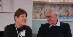
At our regular Speaker Meeting Trudy Hampton gave an informative and sometimes harrowing talk about the homeless in our surrounding area.
more
Speaker Keith Leech gave a fascinating and informative talk on the history of the bonfire and the Gunpowder Plot
more.jpg)
The Wendy Cocker Award for Endeavour for 2025 awarded to Chloe Considine of Sidley Cricket Club.
more.jpg)
Presentations to benificiaries of the 2025 Car Show Warming Up the Homeless, Rye and District Community Transport and the Senlac St Leonards’ Yellowmen.
more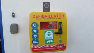
The vandalised defibrillator cabinet at Galley Hill, Bexhill, has been replaced by The Rotary Club of Senlac St Leonards ...
more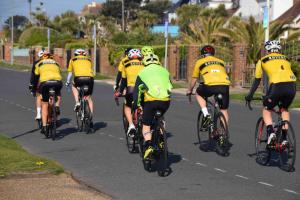
The annual “On-Yer Bike” Castle Challenge, organised by the Rotary Club of Senlac St Leonards, took place on Sunday, 27th April with routes to Pevensey, Magham Down and Beachy Head. Here are some of the photos of the day....
more
Are you a charity or organisation that has an ongoing or potential project to help improve the community and the environment?
moreChartered in 1985, we operate within the Hastings and Rother District of East Sussex, England
more
The Rotary Foundation is the Rotary Charity providing a range of Grants for projects aligning with Rotary's Areas of Focus as well as coordinating our flagship project the eradication of Polio from the World.
more


